

GRAVITY 08 Solutions
Our Challenge Champions
Scottish Environment Protection Agency
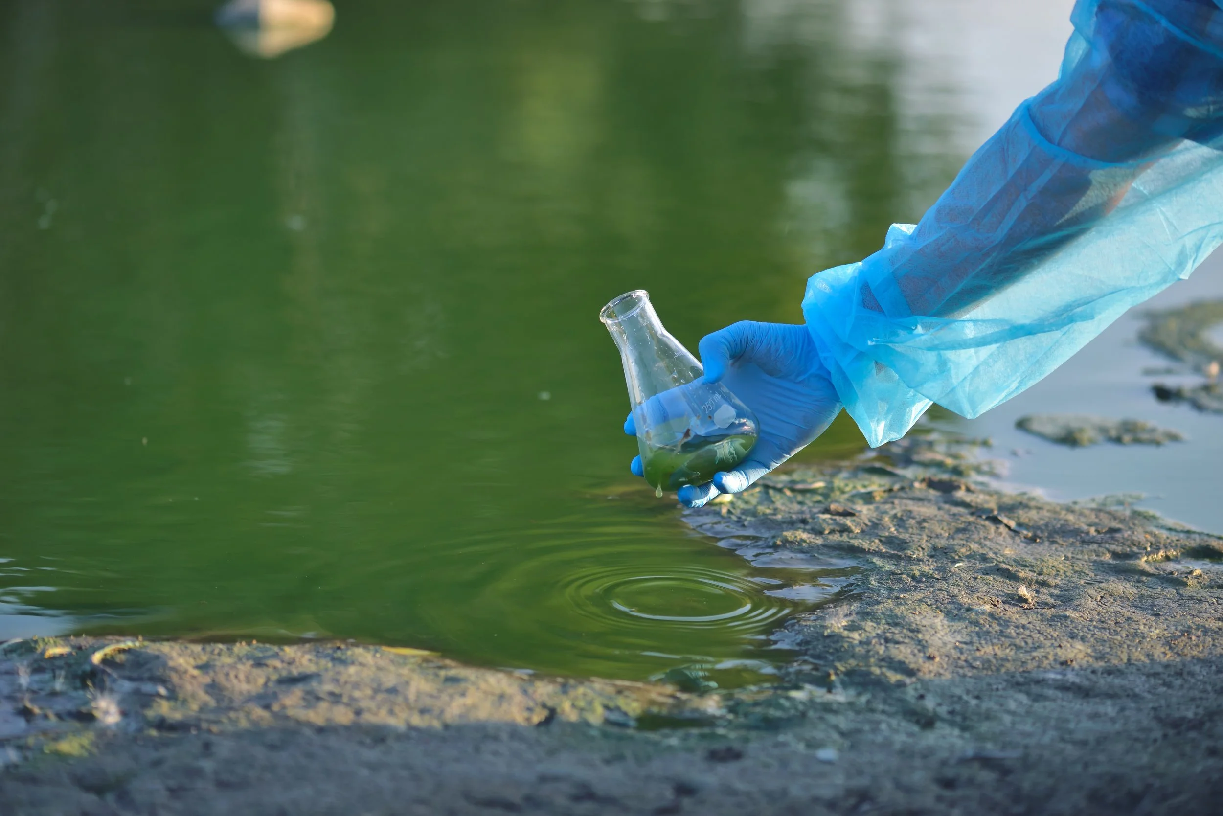
Beyond the Bucket: Reimagining Environmental Sampling from Space
-
A scalable, EO-Driven Water Quality Solution to Complement In-Situ Monitoring
-
4EI’s solution is a scalable, Earth Observation (EO)-driven tool designed to complement and improve the Scottish Environment Protection Agency’s (SEPA) existing water quality monitoring system. It provides a new layer of analysis, creating a hybrid model where in-situ sampling is used to calibrate and validate the efficiency of satellite-derived data. The methodology is based on an automated workflow that uses open-source Sentinel-2 satellite imagery, selected for its 10m spatial resolution and high frequency of collection. A suite of scientific indices, with the Toming's index identified as most effective, is applied to the imagery to detect and map chlorophyll-a concentrations.
This provides a comprehensive, whole-lake view that captures the spatial and temporal variability missed by single-point manual sampling. The primary benefits are a massive reduction in cost and time and a significant increase in productivity. The solution offers predictive capabilities, with the potential to flag algal bloom risks earlier than monthly field sampling. Furthermore, it provides data resilience against events like cyberattacks; because it relies on the open-source Copernicus Sentinel-2 archive, historical analyses can always be rerun if SEPA's own data is lost.
A proof-of-concept has been successfully demonstrated on 10 pilot lochs and validated against SEPA’s in-situ data, showing encouraging alignment in seasonal trends.

Melbourne Water
From Catchment to Coast: Tracking Pollutant Pathways & Water Quality Impact
-
A System for Hazard Identification, Early Warning, and Location Detection of E. coli and Enterococci (SHIELD-E²)
-
Frazer-Nash Consultancy is proposing to develop SHIELD-E², or System for Hazard Identification, Early Warning, and Location Detection of E. coli and Enterococci, a first-of-its-kind system to improve the way microbial contamination events are detected and managed in waterways. Spikes of E. coli and Enterococci threaten public health, impose negative social, economic, environmental and reputational impacts, and damage community trust. Current monitoring involves in-situ sampling that is limited both spatially and temporally. SHIELD-E² integrates satellite imagery, in-situ data, and machine learning to provide catchment-to-coast monitoring and forecasting capabilities to overcome these limitations.
Using publicly available Sentinel-2 data, SHIELD-E² identifies contamination events and predicts plume movement from rivers into Port Phillip Bay, with early results showing over 80% monitoring accuracy, validated against EPA datasets for E.coli and Enterococci sample readings from Melbourne Water. For predictive water quality forecasting, our machine learning models have also enabled early identification of microbial contamination risk based on turbidity as a proxy, with initial results capturing over 70% of variance in the Bay and over 97% of variance in the Yara River when compared to historical data.
These achievements through the Gravity Challenge Innovation Phase have demonstrated significant potential for proactive interventions and management of microbial contaminations. Utilising our proven experience in innovation development and systems engineering, FrazerNash has put forward a clear development plan to deliver a comprehensive system—from pilot phase through to final operational capability, that aligns directly with strategic goals for proactive, scalable water quality management and provides a pathway to broader national and international adoption.
Melbourne Water’s Finalist
-
EO Intelligence Dashboard for Algal Bloom Risk Forecasting
-
NTN Innovations and VegaCosmos have co-developed a scalable Earth Observation (EO) intelligence platform that enables Melbourne Water to monitor pollutant plumes, forecast algal bloom risks, and respond more rapidly to stormwater impacts. The solution combines satellite imagery, artificial intelligence models, and in-situ sensor data to deliver near real-time insights into sediment transport and ecological risk. It visualizes water quality indicators such as suspended particulate matter, chlorophyll levels, and red-edge peak height to support early detection and forecast conditions several days in advance.
Delivered through the VegaCosmos GeoHub interface, the platform is user-friendly, modular, and already proven in smart city environmental monitoring. The system is designed for operational use by planners, scientists, and environmental managers, with a clear focus on accelerating response times and improving forecasting accuracy. Our broader goal is to expand this solution across Australia by 2030, starting with cities that already have AquaWatch infrastructure such as Melbourne and Sydney. This approach ensures nationwide impact and long-term value for public water authorities.
Want to become a