GRAVITY 03 CHALLENGES
AWS
How can developers leverage artificial intelligence and machine learning technologies for image analysis, on orbit, to accelerate and improve the identification and analysis of a high value event of interest (e.g. plumes of smoke indicating a warning of bush fire), and optimize efficiency of the delivery of intelligence to users on Earth?
Bx
SOS: How might we save our soils and regenerate degraded land?
German Automotive OEM
Connected Supply Chain (track & trace of trucks) Real-Time Transport Tracking and Predictive Route-planning for overall operational Improvement of the Connected Supply Chain.
City of Aachen
City of Aachen, like many other cities in the metropolitan region of North Rhine-Westphalia is confronted by environmental effects caused by congested urban traffic and particulate matter pollution. The goal is to help us find new de-carbonization options for example by introducing an improved traffic flow.
Electranet
Clear on transmission line clearance. Help us accurately detect electricity line sag to ensure public and environment safety and enable greater renewable energy output.
Lufthansa Technik
Lufthansa Technik wants to look at the future scenario of aircraft connectivity, which is currently limited by the state-of-the-art technologies (usually satellite communication) and do not provide passengers with the same quality of service they are used to outside an aircraft cabin. The goal is to help us find new options and ways to enable the next generation of aircraft connectivity for example by looking at new communication technologies in flight.
NASA Harvest
Crop Type Mapping - NASA Harvest, faces the challenge to correctly identify the crops detected in satellite imagery. To tackle this challenge, ground-based teams have collected additional data points in the format of images and other information to be mapped with the satellite data. The primary goal is to map this additional data to the satellite imagery and create high quality labels.
Responsible Risk
Valuing Nature - better assessing financial risk: Dynamic data is needed for Investors to describe both impacts on Natural Capital assets & dependencies on Eco-system Services.
Roche Australia
Driving Better Access of Healthcare Services and Supplies. How can real-time satellite data support supply chain management to drive better access to healthcare services and supply?
Rural Bank
Equip Australian farmers with climate management tools to build resilience and strengthen business viability.
UK Hydrographic Office
Optimisation of satellite and environmental data to minimise vessel strikes on marine mammals during port approach and departures.
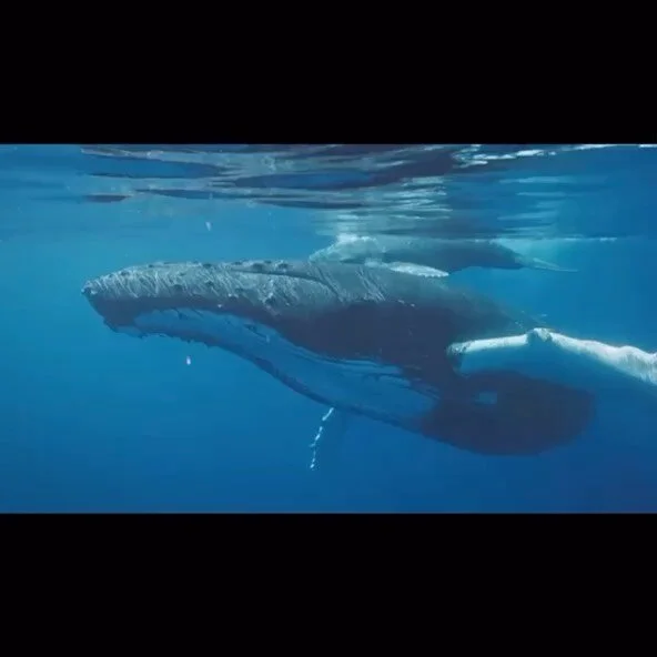
Whale and Dolphin Conservation
How might 21st Century technology solve the mystery of global whale populations and unlock the opportunities of Ocean-based solutions to the climate crisis?